Conduct a GIS records search in Ohio using our GIS records resources.
View our GIS records resources for the state of Ohio. Use these GIS records to search for land ownership maps, cadastral maps, or property line maps. GIS records may contain GIS property search records, property ownership maps, and other public GIS record information.

| County | Resource | Details |
|---|---|---|
| meigs county |
Explore Meigs County through the Interactive GIS Map Portal, offering a comprehensive resource for geographic information and local data in Ohio. |
|
| meigs county |
Explore Meigs County through the Interactive GIS Map Portal, offering up-to-date parcel information and a wealth of geographic data for public use. |
|
| meigs county |
Explore Meigs County through the Interactive GIS Map Portal, offering a comprehensive online mapping tool for property and parcel information in Meigs County, Ohio. |
|
| meigs county |
Explore Meigs County through our interactive GIS maps for detailed property and tax information. Stay informed with the latest updates. |
|
| meigs county |
Meigs County, OH Agriculture Data: Farmland Values & Soil Survey GIS Map |
Explore comprehensive agricultural data on Meigs County, OH, with our GIS map detailing farmland values, soil productivity, crop distribution, and land ownership information. |
| vinton county |
Explore Vinton County's GIS maps for detailed property and boundary information, essential for taxation and planning purposes. Accuracy for legal use is not guaranteed. |
|
| vinton county |
Explore Vinton County's GIS mapping resources for detailed property and geographical information. Visit the Map Room on the 1st floor of the Vinton County Courthouse or access online. |
|
| vinton county |
Explore Vinton County, Ohio's property records with NETR Online's user-friendly Mapping & GIS application, offering both current and historical geographic data. |
|
| vinton county |
Explore comprehensive GIS mapping of Vinton County, Ohio, featuring complete land parcel coverage with detailed property boundaries and essential data for each plot. |
|
| vinton county |
Explore Vinton County's official GIS mapping for surveys and plat maps, providing detailed land information for Harrison, Richland, Jackson, Swan, and more. Updated in 2022 by the Vinton County Engineer and proudly powered by Wix.com. |
|
| vinton county |
Explore the Vinton County Auditor's official website for GIS mapping tools, property information, and contact details for the McArthur, OH office. |
|
| cuyahoga county |
Search the City of Lakewood crime incident map by address and date range. |
|
| cuyahoga county |
Search Cuyahoga County library databases including genealogy and local history resources, historic maps, magazines, newspapers, and general reference materials. A Cuyahoga County Public Library card is required to access these resources. |
|
| cuyahoga county |
Search interactive Cuyahoga County GIS map for property tax and assessment information. Search by owner name, address, or parcel number. Map layers also include foreclosures, soils, elevation contours, flood zones, and political boundaries. |
|
| cuyahoga county |
View the City of Strongsville ward and precinct maps. |
|
| cuyahoga county |
Explore Cuyahoga County's GIS data through the Enterprise GIS Portal. Access maps, property information, and more with the CEGIS Viewer. Visit the Help Guide for assistance. |
|
| cuyahoga county |
Discover and interact with Cuyahoga County's geospatial data through our web-based GIS mapping application. Explore a comprehensive range of GIS resources and utilize tools to analyze and extract valuable information. |
|
| cuyahoga county |
Explore property records and geographic information in Cuyahoga County, Ohio, with MyPlace's comprehensive GIS database and search tools. |
|
| cuyahoga county |
Cuyahoga County GIS Hub - Northeast Ohio's Geospatial Resource |
Explore a comprehensive suite of GIS tools and resources for Cuyahoga County, Ohio, and get insights into the region's geography and infrastructure. Share your ideas and feedback to enhance the GIS experience. |
| cuyahoga county |
Explore a wealth of geographic data and interactive maps provided by the Cuyahoga County Enterprise GIS Department, serving residents and businesses with top-tier mapping solutions. |
|
| portage county |
Search Portage County property tax and assessment records including weekly, monthly, year-to-date sales reports through GIS maps. |
|
| portage county |
Explore Portage County, OH through the Geographic Information Systems (GIS) portal. Find property details, plat maps, and access various GIS tools and resources. |
|
| portage county |
Explore the upgraded Portage County Auditor's Real Estate Search portal for comprehensive property information and GIS data in Portage County, Ohio. |
|
| portage county |
Explore and download Portage County, Ohio GIS parcel data. Obtain detailed parcel geometries and associated records easily for your mapping needs. |
|
| portage county |
Explore a comprehensive GIS database for Portage County, Ohio, featuring the 1976 Ohio Wetlands Inventory, over 3500 oil and gas well locations, and detailed flood hazard area maps. |
|
| portage county |
Explore GIS maps and property information in Portage County, Ohio, provided by the Portage County Auditor's office, located on the 6th floor of the Administration Building. |
|
| portage county |
The Portage County Register of Deeds, led by Recorder Lori Calcei, ensures the safekeeping of vital land records, providing up-to-date, clear, and easily retrievable documents for public access. |
|
| portage county |
The Portage County Register of Deeds Office in Ohio ensures the integrity of property records with comprehensive documentation of land conveyances and encumbrances. |
|
| portage county |
Contact Lori Calcei, the Portage County Recorder, for property records and deeds. Visit the office at 449 S Meridian Street, Ravenna, OH 44266 or call 330-297-3553. |
|
| portage county |
Explore indexed records in Portage County, Ohio with the Lori Calcei Recorder's eSearch module. Access land records and other documents as a guest user. |
|
| portage county |
Portage County, OH Register of Deeds - Recording Information |
Find recording fees and document guidelines for deeds, mortgages, affidavits, agreements, annexations, easements, certificates of transfer, land contracts, leases, and mechanic's liens in Portage County, Ohio. |
| portage county |
Explore Portage County, OH, with our interactive GIS map tools. Find parcel information, zoning details, cemetery locations, and more for comprehensive county insights. |
|
| hocking county |
View Hocking County GIS maps including recorded plats, bench marks, zoning, aerials, voting precincts, floodplains, townships, topographic, and property tax maps. |
|
| hocking county |
Explore a wide range of interactive maps and comprehensive data for Hocking County, Ohio. For detailed GIS resources, visit the official site. |
|
| hocking county |
For inquiries about Hocking County's GIS data or other property information, reach out to the Auditor's Office at 740-385-2127 or the Recorder's Office at 740-385-2031. |
|
| hocking county |
Explore Hocking County, Ohio with NETR Online's user-friendly Mapping & GIS Application, offering a blend of current and historical property data displayed geographically. |
|
| hocking county |
Explore detailed GIS maps of Hocking County, Ohio, provided by the County Engineer's Office and the Mapping and Planning Office, available for free download. |
|
| hocking county |
Explore comprehensive property data and interactive GIS mapping tools for Hocking County, Ohio. Access parcel geometries and associated records with ease. |
|
| wood county |
Search Wood County property tax and assessment records including weekly sales reports, monthly and yearly sales reports through GIS maps. |
|
| williams county |
Search Williams County property tax and assessment records including weekly, monthly and yearly sales reports through GIS maps. |
|
| wayne county |
View Wayne County GIS maps. |
|
| washington county |
Search Washington County property sales, assessment records by parcel maps, address, parcel number, or owner name. |
|
| union county |
Search Union County current property tax records through GIS maps. |
|
| tuscarawas county |
View Tuscarawas County current GIS maps. |
|
| trumbull county |
Search Trumbull County property tax and assessment records including weekly, monthly and year-to-date sales reports through GIS maps. |
|
| summit county |
View City of Akron maps including zoning maps. |
|
| stark county |
View City of Canton maps such zone, streetscape, neighborhood and hike and bike trail system. |
|
| stark county |
View Stark County current GIS maps. |
|
| shelby county |
Search Shelby County property tax and assessment records by owner name, street name including sales search and GIS maps. |
|
| shelby county |
View Shelby County township map list. |
|
| seneca county |
Search Seneca County property tax and assessment records by parcel number including weekly sales reports through GIS maps. |
|
| ross county |
Search Ross County property tax and assessment records including weekly, monthly and year-to-date sales reports through GIS maps. |
|
| putnam county |
View Putnam County Township maps. |
|
| putnam county |
View Putnam County villages plat maps. |
|
| preble county |
Search Preble County property tax and assessment records including weekly, monthly and year-to-date sales reports through GIS maps. |
|
| pike county |
View Pike County GIS maps including property tax and assessment records by parcel number, name and address. |
|
| pickaway county |
View Pickaway County development regulations and GIS maps. |
|
| pickaway county |
View Pickway County maps including historical sites map, county bridge map, and county highway maps. |
|
| ottawa county |
Search Ottawa County property tax and assessment records including weekly, monthly and year to date sales reports through GIS maps. |
|
| muskingum county |
Search Muskingum County property tax and assessment records by name including weekly, monthly and yearly sales reports through GIS maps. |
|
| montgomery county |
View City of Dayton maps such as zip code, census tracts, historic district, sites and parking maps and more. |
|
| montgomery county |
View City of Kettering street maps including city street, zip codes, fire station, vicinity maps and more. |
|
| montgomery county |
View Montgomery County GIS maps for city, village and township. |
|
| mercer county |
Search Mercer County property tax and assessment records through GIS maps by owner name, address, map number, tax number or legal description. |
|
| medina county |
View Medina County tax maps by parcel number and city. |
|
| mahoning county |
View Mahoning County GIS maps including municipal maps, electoral maps and other maps. |
|
| mahoning county |
Search Mahoning County property tax records and school district maps through GIS maps. |
|
| madison county |
Search Madison County property tax and assessment records by parcel, owner or address including weekly sales reports including GIS maps. |
|
| lucas county |
Search interactive Lucas County Engineer's GIS maps for floodplains, bridges, culverts, contours, drainage, survey and traffic data. |
|
| lucas county |
Search for Lucas County property taxes, assessments, parcel maps, sales history, and historical transfer cards. Search by address or owner name. |
|
| lucas county |
Search for Lucas County tax maps by assessor number. |
|
| lorain county |
Search interactive City of Elyria crime map by address and date range. |
|
| lorain county |
Search interactive City of Lorain crime map by address and date range. |
|
| lorain county |
Search for Lorain County property taxes, assessments, parcel maps, and sales history by parcel number, owner name, or address. |
|
| lawrence county |
Search for Lawrence County property taxes, sales, assessments, and parcel maps by parcel number, owner name, or address. |
|
| lake county |
Search interactive Lake County GIS map for Auditor's property records, surveys, and tax maps. Search by parcel ID, address, or owner name. |
|
| lake county |
Search interactive Lake County GIS map by address to find polling locations and elected officials. Details also include polling hours, registration deadline, election date, and ballot. |
|
| knox county |
Search for Knox County recorded documents including deeds, mortgages, finance statements, plats, and maps. Search by name, book and page, or instrument number. |
|
| knox county |
Search for Knox County property taxes, assessments, parcel maps, and sales history by parcel number, owner name, or address. |
|
| jackson county |
Search for Jackson County property taxes, assessments, parcel maps, permit data, and sales history by parcel number, owner name, or address. |
|
| jackson county |
View maps of Jackson County polling locations by municipality. |
|
| huron county |
Search for Huron County property taxes, assessments, parcel maps, and sales history by parcel number, owner name, or address. |
|
| holmes county |
Search interactive Holmes County GIS map for property information as well as areas of interest, utilities, topography, and aerial photos. Search by owner name, address, legal description, or parcel ID. |
|
| highland county |
Search Highland County property taxes, assessments, parcel maps, and sales history by parcel number, owner name, or address. |
|
| henry county |
View Henry County plats, sections corners, and survey location maps. |
|
| henry county |
Search interactive Henry County GIS map for basic parcel information. Search by parcel ID or owner name. |
|
| hardin county |
Search for Hardin County property tax, sales and assessments records by parcel number, owner name, or address. |
|
| hancock county |
Search for Hancock County property taxes, assessments, parcel maps and sales history by parcel number, owner name, or address. |
|
| hancock county |
Search interactive map of Hancock County communities for information about elected officials, meeting times, zoning regulations, land use, and more. |
|
| greene county |
Search Green County historical archives including birth and death records, maps and genealogy records. |
|
| greene county |
View Greene County GIS maps including survey control points, county roads, school districts, voting precincts, and tax map index. |
|
| greene county |
View Greene County plat book conversions. |
|
| greene county |
Search Greene County library databases including local history and genealogy resources, maps, magazines, newspapers, journals, and general reference books. A valid library card is required to access some of these resources. |
|
| greene county |
Search interactive Greene County GIS map for property appraisal, sales, and tax records. Search by owner name, parcel number, or address. |
|
| greene county |
View maps of Greene County voting precincts and districts. |
|
| geauga county |
Search for Geauga County property tax, sales, assessments, building permits, and parcel maps by address, parcel number or owner last name. |
|
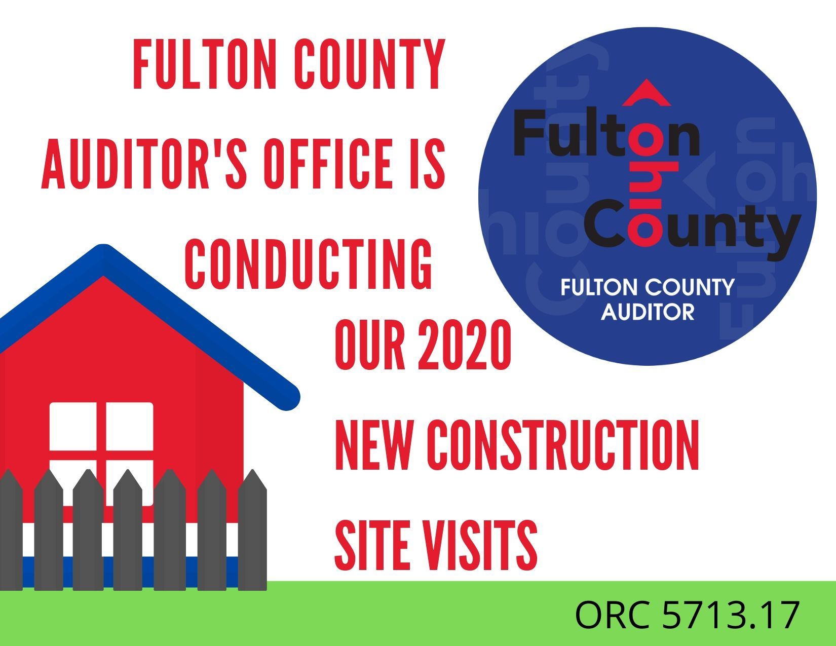
| fulton county |
View static and interactive Fulton County GIS maps including plats, tornado siren locations, street atlas, school and fire districts, floodplains, soils, and zoning. |
|
| fulton county |
Search Fulton County property taxes, sales, assessments, and parcel maps by parcel number, owner name, or address. |
|
| franklin county |
Search the City of Columbus crime incident map by address and date range. |
|
| franklin county |
Search for city-owned properties currently available for sale in the City of Columbus by parcel ID, address, land use type, or acquisition type including maps and online application. |
|
| franklin county |
Search for Franklin County property taxes, assessments, parcel maps, building data, and sales history by parcel ID, owner name, or address. |
|
| franklin county |
Search interactive City of Columbus zoning map to locate properties and view information about the Columbus Zoning Code governing the use of the property. Search by address, owner name, or parcel ID. |
|
| fairfield county |
Search Fairfield County property tax and assessment records through GIS maps. |
|
| clinton county |
Search Clinton County recorded document index including deeds, mortgage books, finance statements, military filings, and plats. |
|
| clinton county |
Search Clinton County property taxes, assessments, parcel maps, and sales history by parcel number, owner name, or address. |
|
| clermont county |
Search Clermont County library databases including genealogy resources, Sanborn fire insurance maps, obituaries, historical newspapers and magazines. A valid library card is required to access some of these resources. |
|
| clermont county |
Search interactive Clermont County GIS maps for basic parcel information, aerial photos, contours, proposed lot splits, road closures and detours, monuments, culverts, and bridges. Search by address, owner name, or parcel number. |
|
| clermont county |
View Clermont County monument maps sorted numerically. |
|
| clermont county |
View Clermont County election precinct map. |
|
| clark county |
Search Clark County property assessments, appraisals, sales, taxes, and parcel maps by owner name, parcel number, or map number. |
|
| champaign county |
Search interactive Champaign County GIS map for basic property information, aerial photos, soils, school districts, and municipal boundaries. Search by parcel ID or address. |
|
| champaign county |
View maps of Champaign County voting precincts by municipality. |
|
| belmont county |
View Belmont County GIS maps including recorded plats, searchable parcel data with aerial photos, tax maps, flood zones, watersheds, voting precincts, and school districts. |
|
| belmont county |
View maps of Belmont County voting precincts by municipality. |
|
| auglaize county |
Search Auglaize County library databases including genealogy and local history resources, Sanborn maps from 1867 to 1970, obituaries, newspapers, magazines, and general reference materials. A valid library card number is required to access most of these resources. |
|
| auglaize county |
Search for Auglaize County property taxes, assessments, parcel maps, permit data, and sales history by parcel number, owner name, or address. |
|
| auglaize county |
Search interactive Auglaize County GIS map for property records by owner name, parcel ID, address, or legal description. Map layers also include topography, roads, utilities, and aerial photos. |
|
| athens county |
Search for Athens County property taxes, assessments, parcel maps, permit data, and sales history by parcel number, owner name, or address. |
|
| ashland county |
View Ashland County highway and municipality maps. |
|
| allen county |
Search interactive Allen County GIS map for property sales and assessment records. Search by parcel number, address, owner name, or lot number. |
|
| paulding county |
View Paulding County plat maps, historical maps and flood plain maps as well as aerial photos. |
|
| licking county |
View Licking County GIS maps available for download. Static maps include road centerlines, parcel maps, municipal boundaries and other maps.. |
|
| guernsey county |
View Guernsey County GIS maps including historical plats, watersheds, cemeteries, historic oil and gas, abstract cards, topographic, and tax maps. |
|
| defiance county |
Search Defiance County plat book records. |
|
| brown county |
Search interactive Brown County GIS map for parcel ownership history, auditor's data, plats, tax maps, recorded deeds, and soils. Search by parcel number, owner name, address, or subdivision. |
|
| coshocton county |
Search Coshocton County crime incident map by address and date range. |
|
| butler county |
Search the City of Middletown library databases including local history and genealogy resources, newspaper obituaries and death notices, Sanborn fire insurance maps, magazines, newspapers, and general reference materials. A valid library card number is required to access these resources. |
The information provided on this website about U.S. States, Counties, and Cities, is compiled from publicly available sources and is made available “as is” for informational purposes only. No representations, warranties or guarantees are made as to the accuracy, adequacy, reliability, currentness, completeness, suitability or applicability of the information contained on this website for any particular purpose. All 3rd party trademarks are for reference purposes only. PublicRecords.com powered by Intelius is a privately owned website and is not a direct source of government records or services and not affiliated with any government agency.
Below, you will find a list of offices in Ohio that may hold GIS maps. When requesting GIS records from these offices, it's important to be aware of any procedures, requirements, and fees associated with obtaining the records. Contacting the respective office directly will provide you with the most accurate and up-to-date information regarding access to GIS records in Ohio.
| Image | Office | Address | Phone |
|---|---|---|---|
 |
31 North Limestone St., Springfield, OH 45501 | (937)-521-1891 | |
 |
152 South Fulton St., Suite 165, Wauseon, OH 43567 | (419)-337-9200 | |
 |
226 Middle Ave., 2nd Floor, Elyria, OH 44035 | (440)-329-5207 | |
 |
101 North Main St., Room 105, Celina, OH 45822-1794 | (419)-586-6402 | |
 |
129 E. Court St. Floor 3, Sidney, OH 45365 | (937)-498-7202 | |
 |
2nd Floor, One Courthouse Square, Bowling Green, OH 43402 | (419)-354-9150 | |
 |
230 Waverly Plaza, Suite 200, Waverly, OH 45690-1222 | (740)-947-2713 | |
 |
One Government Center, Suite 600, Toledo, OH 43604 | (419)-213-4406 | |
 |
300 S Main St, Findlay, OH 45840 | (419)-424-7015 | |
 |
210 East Main St., Lancaster, OH 43130 | (740)-687-7185 | |
 |
46 S. South St., Wilmington, OH 45177 | (937)-382-2067 | |
 |
46 S. South St., Wilmington, OH 45177 | (937)-382-2250 |
The information provided on this website about U.S. States, Counties, and Cities, is compiled from publicly available sources and is made available “as is” for informational purposes only. No representations, warranties or guarantees are made as to the accuracy, adequacy, reliability, currentness, completeness, suitability or applicability of the information contained on this website for any particular purpose. All 3rd party trademarks are for reference purposes only. PublicRecords.com powered by Intelius is a privately owned website and is not a direct source of government records or services and not affiliated with any government agency.
Compiled by: Chris E. | Reviewed by: Blake A. | Last update: 03/13/24
Ohio has a variety of GIS records that are accessible to anyone. These records encompass a wide range of data allowing individuals to access and review available information online. Records can include but are not limited to, land ownership maps, property lines maps, and cadastral mapping information. We compile our resource lists from reliable government agencies to ensure ease in your search.
If you couldn't find the resource you were searching for, go to the Ohio Property & Land Records page for other public records resources. Looking for something other than property and land tax records in Ohio? Search the database of all public records available.
Visit our Contact Us page to report any issues.
Use the citation tool to easily create a properly formatted citation or reference. Select the format you’d like to use and copy the link from the screen below.
The information provided on this website about U.S. States, Counties, and Cities, is compiled from publicly available sources and is made available “as is” for informational purposes only. No representations, warranties or guarantees are made as to the accuracy, adequacy, reliability, currentness, completeness, suitability or applicability of the information contained on this website for any particular purpose. All 3rd party trademarks are for reference purposes only. PublicRecords.com powered by Intelius is a privately owned website and is not a direct source of government records or services and not affiliated with any government agency.
This site contains REAL public records data including criminal records, background reports, photos, court documents, address information, phone numbers, civil judgments, properties owned, social media profiles, and much more.
PublicRecords.com powered by Intelius does not provide consumer reports and is not a consumer reporting agency under the Fair Credit Reporting Act. We provide information (criminal record, address, phone number, property, civil judgment, and more) that can be used to satisfy your curiosity, protect your family, and find the truth about people in your life. To use our site you must certify below that you agree to our Privacy Policy and Terms of Use and will NOT use our site or the information we provide: